Screenshots
Overview
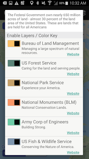
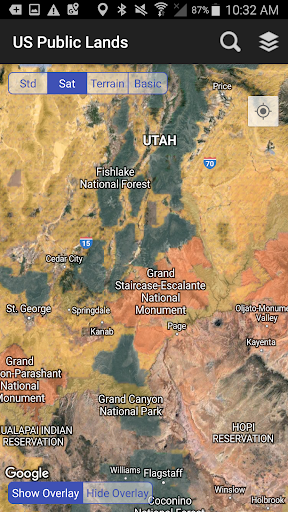
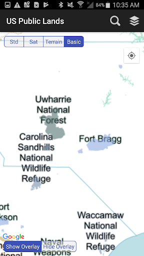
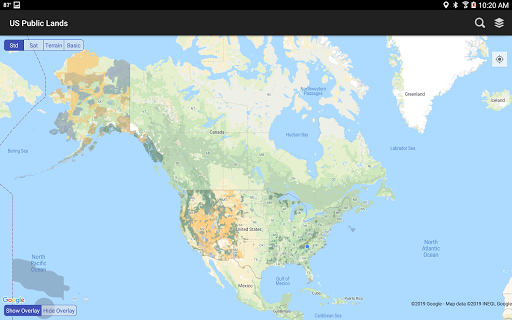
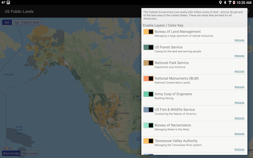
The US Federal Government owns nearly 650 million acres of land - almost 30 percent of the land area of the United States. These are lands that are held for all Americans. Up until now, there has been no quick & easy way to retrieve the boundaries of these properties without carrying physical maps, books, or slowly digging deep online. Included in this app are on device (fully works offline), individually selectable & beautifully colored layers for most of the properties administered by the federal government: Bureau of Land Management (Blm) US Forest Service (FS) National Park Service (Nps) Army Corp of Engineers (Acoe) US Fish & Wildlife Service Bureau of Reclamation Tennessee Valley Authority Department of Defense (military bases & installations) Other (National Laboratories, Test Sites, etc.) Key Benefits & Features Know which US agency owns and operates the land you're on or are heading to.
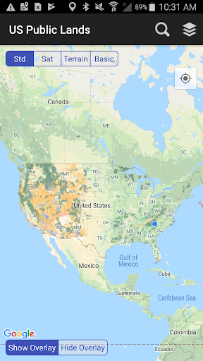
Use the "Layers" icon to select which agencies you want displayed to create your own custom map. (Hint, the toggles are color coded to the color each layer is displayed in.) Links are provided to each agency's website within the app, so that you can further your research as to what land use rules apply for each public land type - such as permits, fees, activities allowed, and limits of stay.
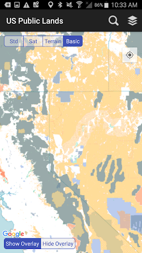
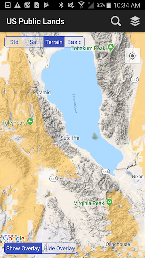
Map layers are stored on device - no internet connection required. Be sure to turn on the 'Basic' base map to see the US Public Land labels for each land area. This base map layer is also stored entirely on your device, and can be utilized if you do.
Features
Not have an internet connection or would like to conserve bandwidth. If you have an internet connection, you can utilize standard and satellite view maps as well as the base layer underneath the public land overlays. A boondocker's assistant While US Public Lands is not specifically a camp site locator and does not have a database of specific sites, by turning on the satellite view map, you can better scout out trails, roads and signs of dispersed camping locations within the boundaries of the public land resources. Quickly toggle between 'Show' and 'Hide' via the "Map" icon to more clearly see satellite images below.
If you have GPS access on your device, click the 'Locate Me' icon to show your pr. The interface is organized for quick access to the most frequently used functions, reducing the time needed to complete common tasks. Advanced options are available for users who want to customize their experience and optimize the application for their workflow. Data sync and backup features help users keep their information safe and accessible across multiple devices when needed. The application supports a wide range of file formats and integrates with popular services to extend its usefulness. Performance optimization ensures smooth operation even on older hardware, making it accessible to a broad user base.
Comprehensive documentation and in-app guidance help new users get started quickly while power users can explore advanced capabilities. Users can organize content, apply filters, and access key functions through an intuitive layout that minimizes learning curve. Cross-platform support and cloud integration extend the application's reach across different devices and ecosystems. Built-in tutorials and contextual help ensure that users can discover and master features at their own pace. The interface is organized for quick access to the most frequently used functions, reducing the time needed to complete common tasks.
Pros
- User-friendly interface for smooth experience
- Comprehensive feature set for various needs
- Regular updates and maintenance
- Widely used and well-reviewed
- Good value for the functionality offered
Cons
- May have a learning curve for new users
- Some features may require subscription
- Performance may vary by device
- Interface design could be improved
- Support availability may be limited
Top Apps

Alien Food Invasion Premium
Enjoy the alien invasion without ads and without any pay-to-win purchases! br br Improve ...
Big Boss Idle Business Tycoon
BUILD, AUTOMATE, PROFIT - THE ULTIMATE IDLE BUSINESS TYCOON GAME br br Grow from $100 to ...

Christmas Magic
? Christmas Magic Watch Face for Wear OS ? br br Unwrap the joy of the season with our Ch...

Christmas Snow On/Off Watch
Collection https://play.google.com/store/apps/dev?id=5351976448109391253 br Pretty and cut...
Christmas Village
font color="#28c0fa" Perfect watch face for this Christmas season! /font br br b Teleg...

Code Blue CPR Timer
Code Blue CPR Timer was developed and extensively tested to provide crucial information in...

Coexisting Diseases & Surgery
A comprehensive medical disease app that contains the following: br br 1) Gives the descr...
Currency Converter Pro
No Ads. br br Currency Converter providing real time exchange rates for over 180+ currenc...
Similar Apps

IHG One Rewards: Book Hotels
Book and earn rewards at 6,800+ destinations across 20 hotel brands worldwide with the IHG...

Lime - #RideGreen
You have places to be and people to see. Get there easily and on time with an emissions-fr...

Marriott Bonvoy: Book Hotels
Book directly with Marriott Bonvoy to enjoy exclusive offers, take the stress out of trave...

Mobile Passport Control
Mobile Passport Control (MPC) is an official application created by U.S. Customs and Borde...

Turo — Car rental marketplace
Turo is the world’s largest car sharing marketplace, where you can rent the perfect car fo...

Viator Tours & Attractions
Thanks to industry-leading flexibility and last-minute availability, it's never too la...

Zoox
It’s not a car. It’s a robotaxi designed around you. br br Zoox is fully autonomous, all-...

Booking.com: Hotels & Travel
Save on your next trip with the Booking.com app! Find great hotel or apartment deals and b...