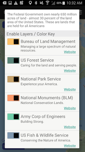
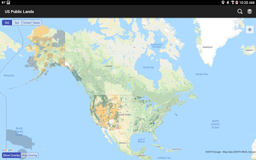
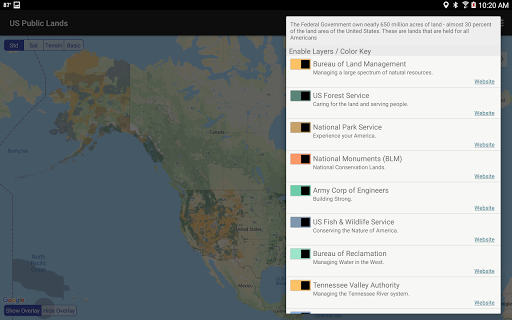
US Public Lands is a comprehensive mapping application that provides users with detailed information about federal lands across the United States. With nearly 650 million acres of land owned by the US government, this app allows you to access boundaries and details of properties managed by various agencies without an internet connection. Key agencies covered include the Bureau of Land Management (BLM), US Forest Service (FS), National Park Service (NPS), and more.
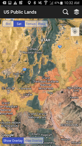
The app's core functionality lies in its ability to display individually selectable layers for each agency's land, beautifully color-coded for easy identification. Whether you're planning a hiking trip or need to know the rules governing public land use, US Public Lands provides essential data at your fingertips. The app also includes links to each agency's website for further research on permits, fees, and activity restrictions.
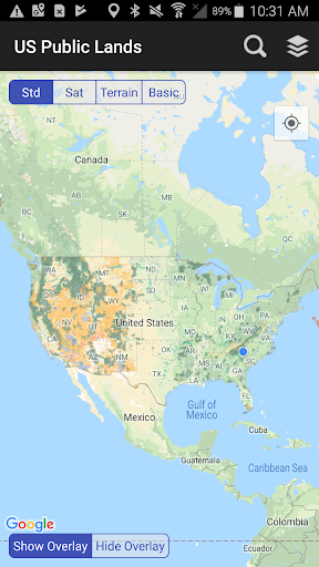
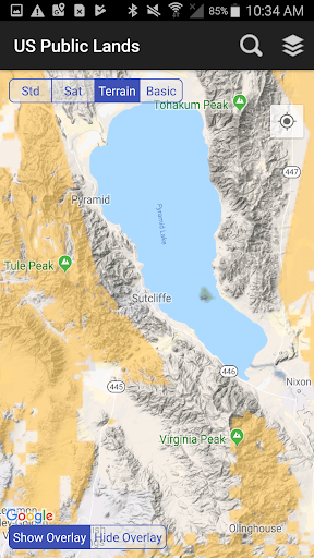
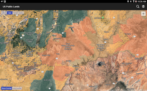
This app is particularly useful for outdoor enthusiasts, researchers, and anyone needing reliable information about public lands. By combining offline map layers with real-time GPS location services, it ensures users can navigate confidently even in areas with limited connectivity. The built-in search tool and satellite view options make it easier than ever to scout potential camping spots and understand land ownership details.
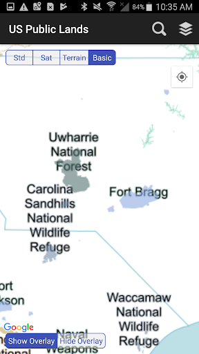
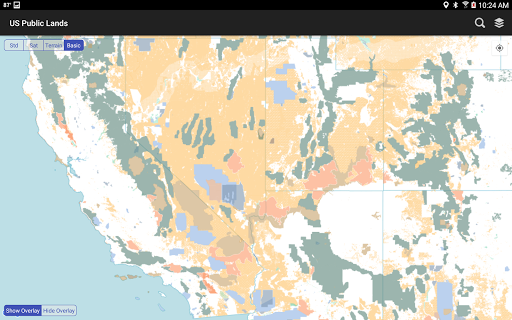
One of the standout features of US Public Lands is its robust offline functionality. All map layers are stored directly on your device, allowing you to access critical information without an internet connection. This includes not only boundary data but also a basic base map layer that displays labels for each public land area, ensuring usability regardless of connectivity.
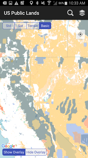
The app offers extensive customization options through its 'Layers' feature. Users can select which agencies they want displayed on their custom maps, using color-coded toggles for easy management. Additionally, quick toggle options between 'Show' and 'Hide' views allow for clearer examination of underlying satellite images, enhancing the scouting process for dispersed camping locations.
For those with GPS-enabled devices, the 'Locate Me' function provides precise location tracking, helping users identify what type of land they're currently on. The built-in search tool supports various queries including cities, states, zip codes, and points of interest, dropping pins at searched locations. These features collectively ensure that users have a versatile and powerful tool for exploring public lands across the United States.
User-friendly interface
Offline map access
Customizable layers
Accurate GPS tracking
Comprehensive agency coverage
No campsite database
Occasional accuracy issues
Limited private land info
Requires updates
Varied resolution quality

Get all MTA services, Subway, Bus, LIRR, Metro-North and More all in one place.
 4.60
4.60
Book neighborhood dog boarding, dog walking, pet sitting, and doggy day care.
4.60
Discover the power of one-way location tracking. Share your location securely.
4.50
Real-time flight tracking with live maps and flight status updates.
3.70
Vacationing on CARNIVAL? Maximize your fun on board with the ultimate cruise app
4.60
Travel light with our easy-to-use mobile app, the perfect flying companion.
4.40
Offline WiFi Hotspot Finder, eSIM, Caller ID, Dialer, Home Screen Launcher & VPN
4.20
Get the app that knows where you’re going - view your flight, check in & more
4.50
Now you can book homes, experiences, and services—all in our redesigned app.
4.40
The travel app that makes booking cheap flights, hotels, and car rentals easy.
4.80
Bus tickets at unbeatable prices with routes across the US. All aboard FlixBus!
4.70
With the Spirit Airlines app, easily manage all your trips in one place.
4.70
Walt Disney World Resort maps, wait times, tickets, dining & more.
4.50
A tool for outdoor activities.
4.30
GPS Live Satellite Earth to find route navigation and current location map
4.00
Examine the planet
3.80
A Camino de Santiago Guidebook from St. Jean Pied de Port to Santiago
3.60
Tide Table Chart provides quick and easy access to high and low tide forecasts.
3.20
A packing list app that helps you remember what to pack for a trip.
3.10


User Reveiws