
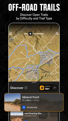


onX Offroad is a premier off-road navigation application designed for outdoor enthusiasts who crave adventure beyond the pavement. The app provides comprehensive 3D trail maps, GPS mapping, and compass navigation, making it easier than ever to discover trails tailored to various off-road vehicles including 4x4s, SxS, dirt bikes, and snowmobiles.
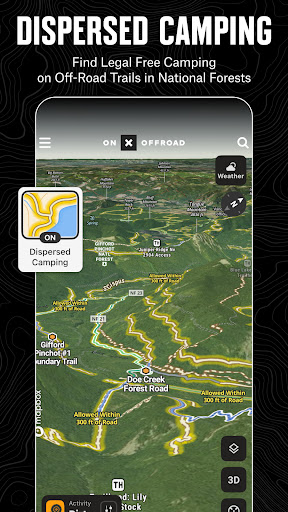
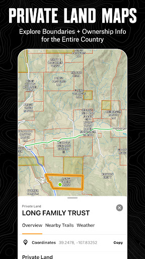
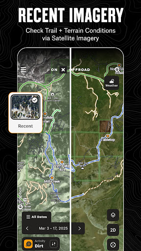
One of the standout features of onX Offroad is its ability to filter trails by vehicle accessibility and identify legal, free off-grid camping areas using verified USFS data. Whether you're planning your next overland expedition or simply exploring nearby trails, this app ensures you have all the necessary information at your fingertips. With property lines, private landowner details, and acreage viewable directly within the app, users can navigate confidently while respecting land boundaries.
The app also incorporates crucial safety features such as wildfire activity tracking and air quality forecasts, ensuring users remain informed and safe during fire season. Additionally, cell coverage layers provide up-to-date information on AT&T, Verizon, and T-Mobile coverage, keeping users connected even in remote areas. With offline map capabilities and Android Auto integration, onX Offroad is an indispensable tool for any off-road adventurer.
onX Offroad boasts an impressive array of features that cater to the diverse needs of off-road enthusiasts. One of the core functionalities includes OHV Trails & Map Layers, which allows users to find trails specific to their activity, be it SxS, 4x4, ATV, or snowmobiling. Users can toggle various map layers to access real-time weather updates, land boundaries, and cell service information, ensuring they are well-prepared for any journey.
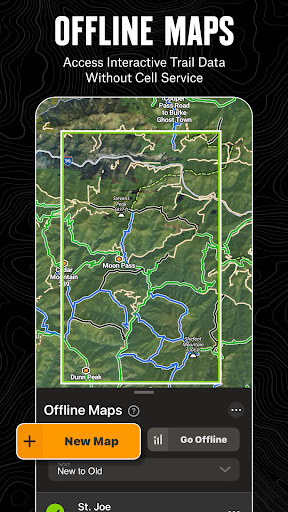
Offline Navigation & Route Builder is another significant feature, enabling adventurers to save maps without losing interactive data. This functionality supports off-road turn-by-turn directions with voice commands and syncs seamlessly with Android Auto. The route builder automatically snaps to roads and trails, providing a smooth navigation experience even in areas with no cell service.
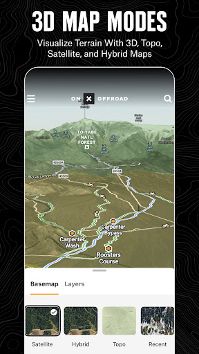
Trip Tracker & Recreation Points further enhance the user experience by allowing tracking of distance, location, speed, and elevation. Users can add waypoints to mark important locations such as campsites and fuel stations, and customize maps with recreation points. For those needing nationwide property lines, onX Offroad offers detailed GPS navigation and versatile map imagery, including topographic and satellite views, ensuring comprehensive coverage across the United States.
Comprehensive trail maps
Real-time safety features
Offline map capability
User-friendly interface
Wide range of vehicle support
Premium features require subscription
Occasional GPS inaccuracies
Heavy data usage
Limited international coverage
Steep learning curve for beginners

America’s largest public fast charging network, with over 500 charging stations.
 4.50
4.50
Number locator, real connection map
4.10
Maps, Driving Directions & GPS navigation using directions app & GPS App
4.30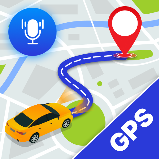
Navigate via GPS Maps of GPS Voice Navigation, driving directions to find routes
3.60
GPS Navigation: Get map directions and find the shortest routes to avoid delays!
4.00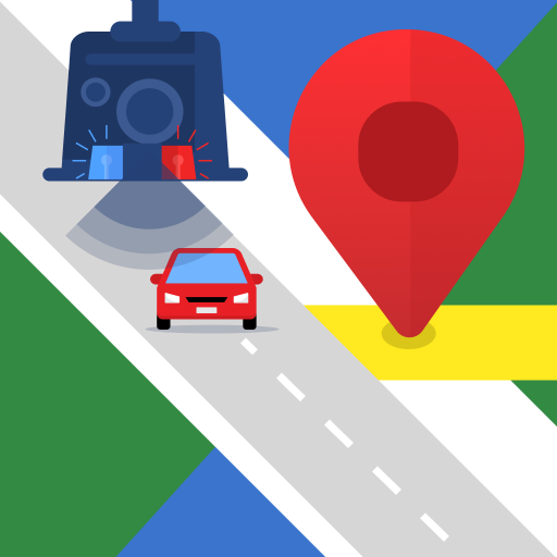
Explore offline maps with radar, satellite view, and real-time alerts.
3.60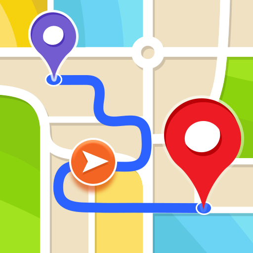
Get route, find shortest path, near by places and weather update
3.90
Ride or drive at YOUR price
4.70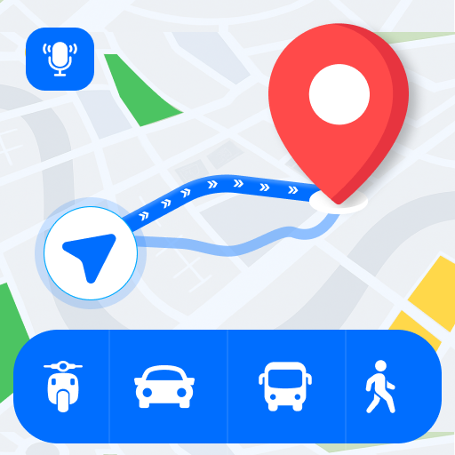
Route Planner is travel map to get turn by turn navigation & driving directions
3.90
Get there with the Waymo Driver — The World’s Most Experienced Driver™
4.90
Find shortest way and save energy . Distance and area calculator.
4.70
GPS Speedometer & Odometer: Track car, bike, truck speed & distance in real-time
4.70
Affordable rides and food delivery with incredible discounts in just one app.
4.50
CamSam PLUS - The speed and red light camera warning system!
4.40
ParkWhiz, an Arrive Mobility brand, part of the Arrive Network
4.30
Simple & easy to use a compass app. Get accurate directions.
4.20
Lets explore the world's famous places by using Live Cams, GPS & Satellite View.
4.20
Get directions, Maps, GPS navigation & GPS Maps using GPS App
4.10
Explore Live Earth Map with 3D World Map & locate cites, mountains real time.
3.80


User Reveiws