

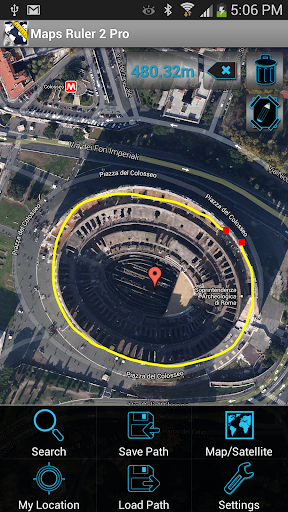
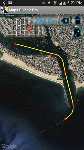

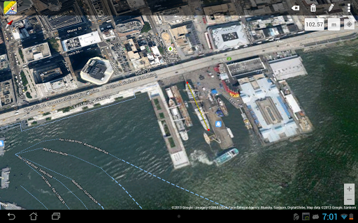
Maps Ruler Pro is a powerful navigation tool designed to calculate distances between multiple points on a map. This app proves especially useful for outdoor activities, allowing users to determine the shortest path to save energy or even serve as a golf distance calculator in yards. With its intuitive interface, it provides accurate measurements and conversions in various units including meters, kilometers, miles, feet, and fathoms.
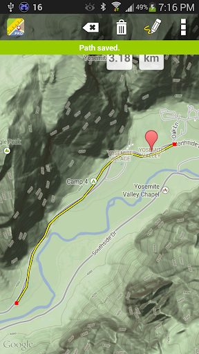
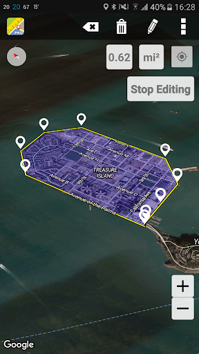
In addition to basic distance calculation, Maps Ruler Pro offers advanced features such as area calculation mode (currently in Beta), continuous path drawing, naming paths, and saving/loading paths for future reference. These functionalities make it an essential app for anyone needing precise measurements for professional or recreational purposes. Whether you're planning a hiking trip or mapping out a construction site, Maps Ruler Pro delivers reliable data to enhance your project's accuracy.
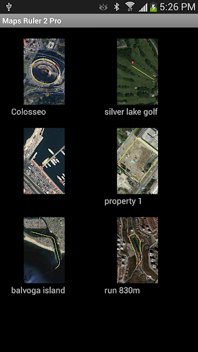
Maps Ruler Pro stands out with its comprehensive set of features tailored for precision and convenience. One notable feature is the continuous path calculation, which allows users to draw paths seamlessly while the app calculates distances in real-time. This functionality is complemented by the ability to name paths, making organization and future reference straightforward and efficient.
Another significant advantage is the app's support for multiple measurement units, catering to a global audience with diverse needs. Users can switch between metric and imperial systems effortlessly, ensuring compatibility with their specific requirements. Furthermore, the pro version eliminates ads, providing an uninterrupted experience, and includes additional capabilities like path saving/loading, enhancing productivity and ease of use for professionals and hobbyists alike.
Accurate distance calculations
User-friendly interface
Multiple unit conversions
Continuous path drawing
No ads in pro version
Beta limitations in area mode
Limited free features
Requires learning for new users
Occasional bugs reported
Premium version costs

Find AI powered cameras, ALPRs, and other surveillance infrastructure near you
 4.70
4.70
Offline maps for phone and smart watch: topographic maps, satellite images...
3.30
Order a cab online. An affordable taxi ride and driver in no time. What a bolt!
4.80
Navigate confidently with our precise Digital Compass app & Direction Compass!
4.70
Navigate via GPS Maps of GPS Voice Navigation, driving directions to find routes
3.60
Get route, find shortest path, near by places and weather update
3.90
Ride or drive at YOUR price
4.70
Neshan: map & navigation app with 20M+ monthly active users
4.50
Track friends in real-time and explore worldwide live cameras.
4.60
This app is military GPS coordinate systems helper. (MGRS, UTM & DMS Maps)
4.80
GPX Viewer PRO shows tracks, routes and waypoints from gpx and kml files.
4.60
Find trails, organize your locations and navigate with offline maps.
4.60
Navigate with your watch and keep the phone in your pocket!
4.60
Affordable rides and food delivery with incredible discounts in just one app.
4.50
Get directions, Maps, GPS navigation & GPS Maps using GPS App
4.10
Easy, Moderate and difficult offroad adventures.
4.00
TACNAV-X: Precision MGRS navigation, built specifically for the military.
4.00
NJ TRANSIT information and ticketing at your fingertips
3.70
Explore offline maps with radar, satellite view, and real-time alerts.
3.60

User Reveiws