


AlpineQuest Off-Road Explorer is a comprehensive outdoor navigation app designed for adventurers and sports enthusiasts. This versatile application supports hiking, running, trailing, hunting, sailing, geocaching, and off-road navigation. The app provides access to numerous online topographic maps that can be stored locally, ensuring availability even without cell coverage. It also supports various file-based raster map formats for offline use.
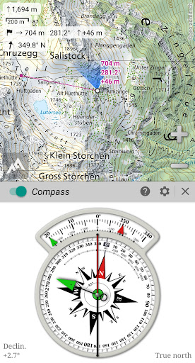
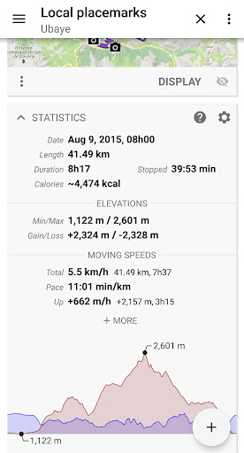
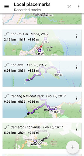
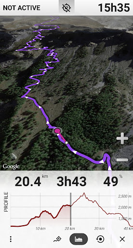
Using your device's GPS and magnetic sensor, AlpineQuest offers real-time location tracking on the map, which can be oriented to match your viewing direction. You can save unlimited placemarks, track your path, and receive advanced statistics and interactive graphics. The app remains fully operational out of cell coverage, making it ideal for wilderness exploration.
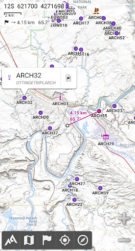
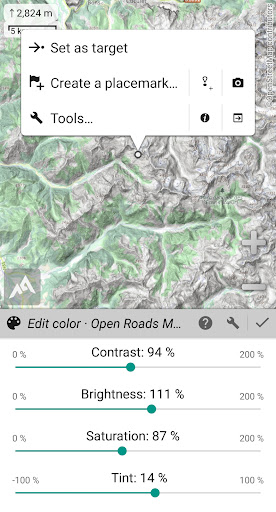
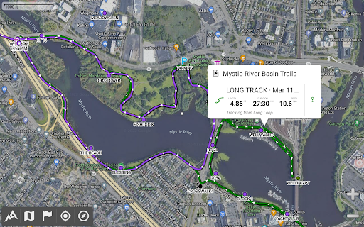
AlpineQuest Off-Road Explorer stands out with its extensive mapping capabilities. It includes built-in online maps with automatic local storage, supporting road, topo, and satellite maps. Users can download additional maps from a community list and store areas for offline use. The app supports various offline map formats like KMZ, OziExplorer, GeoTiff, GeoPackage, MbTile, SqliteDB, and TMS zipped tiles.
Beyond maps, AlpineQuest offers robust placemark management. Users can create, display, save, and restore an unlimited number of waypoints, routes, areas, and tracks. Import/export functionalities support GPX, KML/KMZ, CSV/TSV, ShapeFile, OziExplorer, GeoJSON, IGC tracks, Geocaching LOC, and AutoCAD DXF files. Advanced statistics and interactive graphics provide detailed insights into your activities.
User-friendly interface
Extensive map support
Real-time location tracking
Advanced statistics
Offline functionality
No third-party libraries
Limited social features
Complex for beginners
High storage requirements
Premium pricing
Compass is an accurate compass and a great tool for any outdoor activities
 4.1
4.1
Phone Tracker and GPS Location Sharing
4.20
Find routes fast with GPS Maps, GPS Navigation & driving directions.
4.10
Bolt is a ride-hailing app for requesting fast, safe, and affordable transport
4.80
Get real-time bus and train schedules for easy, hassle-free city transportation.
3.90
Use GPS Maps and GPS Voice Navigation to find your way and get directions
4.10
GPS phone tracker, family locator, secure location sharing app
4.20
Get there with the Waymo Driver — The World’s Most Experienced Driver™
4.90
Navigation, weather, offline maps & tools for smarter, safer travel planning.
4.00
Airport parking, with airport shuttle (TPS shuttle), reservations, and Spot Club
4.80
Truck Safe GPS Navigation & Maps: Parking, Fuel, Diesel, Weight Station
4.80
Find EV & Tesla charging stations with PlugShare
4.70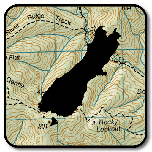
Complete offline 1:50k South Island topo map including DOC Hunting Permit Areas
4.60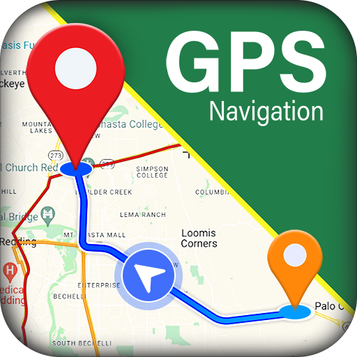
GPS navigation offers route finder, compass, translator, currency converter, etc
4.30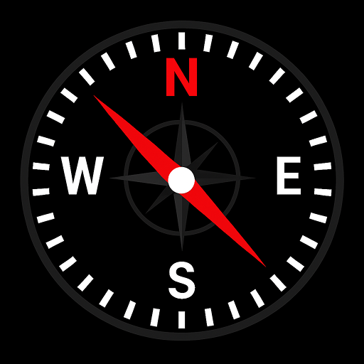
Simple & easy to use a compass app. Get accurate directions.
4.20
Get directions, Maps, GPS navigation & GPS Maps using GPS App
4.10
Avoid delays. Get real-time GPS navigation, safety alerts and live traffic.
4.10
Gas Station & Fuel Rewards Points
3.70
Turn your tablet or Android powered unit into a full blow Android Auto headunit.
2.30

User Reveiws