


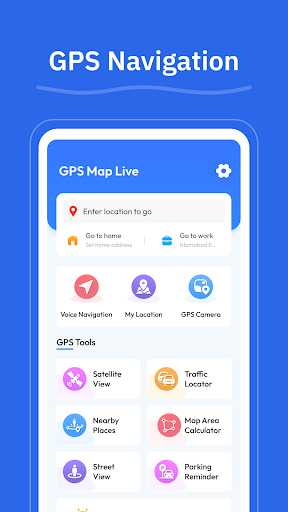


GPS - Maps, Driving Directions is a comprehensive navigation app tailored for travelers across the United States. The app provides essential tools such as turn-by-turn voice guidance, real-time GPS tracking, and clear driving directions for highways, interstates, and local roads. With features like route optimization based on current road conditions and street view functionality, users can confidently navigate busy cities or plan cross-country trips.
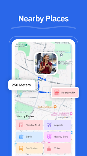
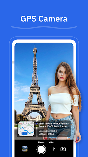
In addition to its core navigation capabilities, the app offers practical utilities including a GPS camera for geo-tagging locations, nearby place searches for amenities like gas stations and restaurants, and a My Location feature that ensures users always know their exact position. Whether commuting daily or embarking on long road trips, this app enhances travel experiences by simplifying route planning and exploration.
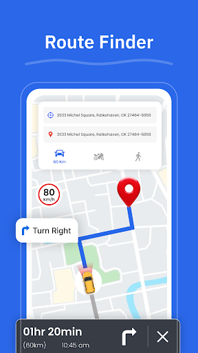
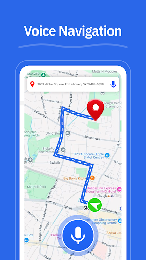
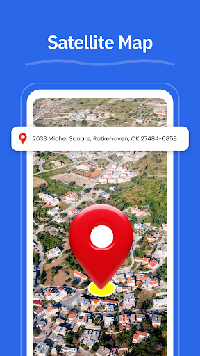
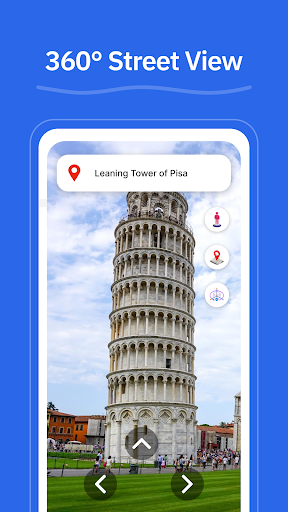
One of the standout features of GPS - Maps, Driving Directions is its robust set of navigation tools. The app delivers turn-by-turn voice guidance, allowing drivers to focus on the road without needing to look at their devices constantly. Its route finder optimizes paths according to live traffic updates, ensuring efficient travel times. Additionally, the street view option lets users preview areas, neighborhoods, and landmarks before arriving.
Beyond basic navigation, the app includes several innovative features. The GPS camera allows users to save locations with geo-tagged photos, making it easy to revisit favorite spots. The nearby places function helps locate essential services such as gas stations, restaurants, ATMs, EV chargers, and pharmacies. Furthermore, the My Location tool provides real-time GPS tracking, giving users peace of mind about their current whereabouts. These features collectively create an intuitive and reliable navigation experience.
User-friendly interface
Accurate GPS tracking
Voice-guided navigation
Real-time traffic updates
Comprehensive location tools
Limited international maps
Occasional ads in free version
Requires internet connection
Consumes significant storage
No offline mode available

Find AI powered cameras, ALPRs, and other surveillance infrastructure near you
 4.70
4.70
America’s largest public fast charging network, with over 500 charging stations.
4.50
Plan routes, share locations, and set custom alert zones
4.40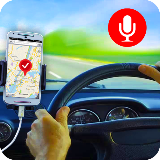
Maps, Driving Directions & GPS navigation using directions app & GPS App
4.30
Affordable rides and food delivery with incredible discounts in just one app.
4.50
MapQuest is your go-to app for maps, GPS, voice navigation & live traffic.
3.80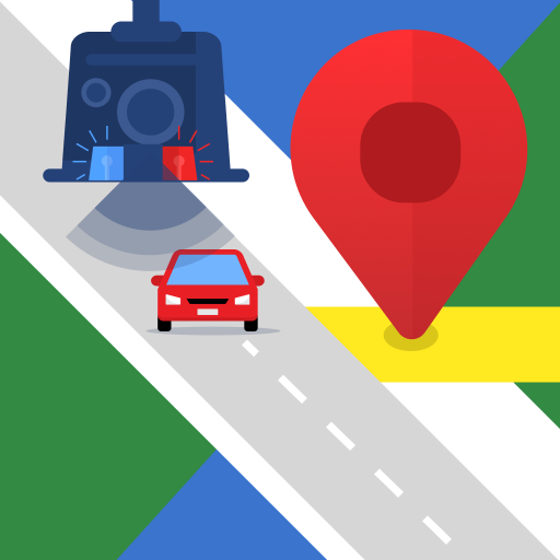
Explore offline maps with radar, satellite view, and real-time alerts.
3.60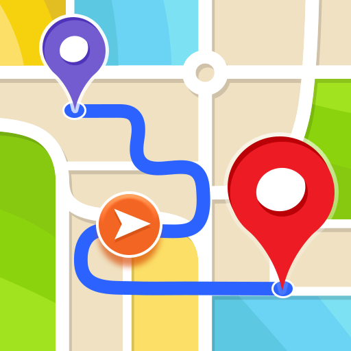
Get route, find shortest path, near by places and weather update
3.90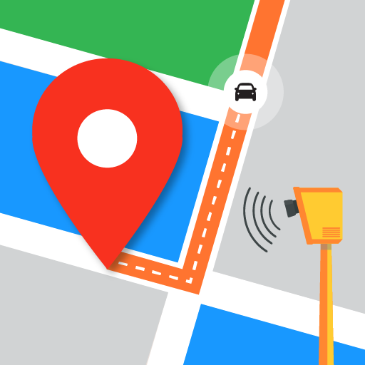
Find radar, speed camera, flight tracker. Use hud, location tracker, speedometer
4.20
This app is military GPS coordinate systems helper. (MGRS, UTM & DMS Maps)
4.80
Bolt is a ride-hailing app for requesting fast, safe, and affordable transport
4.80
Find shortest way and save energy . Distance and area calculator.
4.70
Route tracker, Speedometer, Odometer, Fuel, HUD mode, save route as .GPX
4.40
Number locator, real connection map
4.10
Get route map navigation with 3D satellite view, and live earth camera streaming
3.70
Your guide to the recreational opportunities of the Bureau of Land Management!
3.40
Your real-time window to the world. Explore anywhere, anytime.
3.30
Turn your tablet or Android powered unit into a full blow Android Auto headunit.
2.30
Compass is an accurate compass and a great tool for any outdoor activities
4.5

User Reveiws