
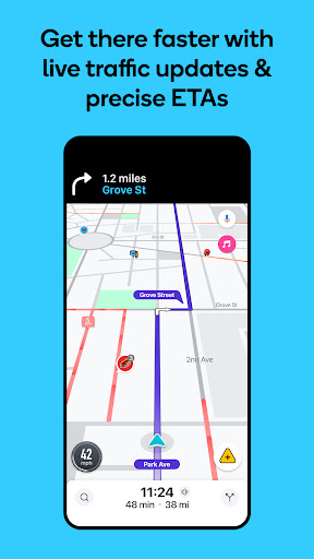


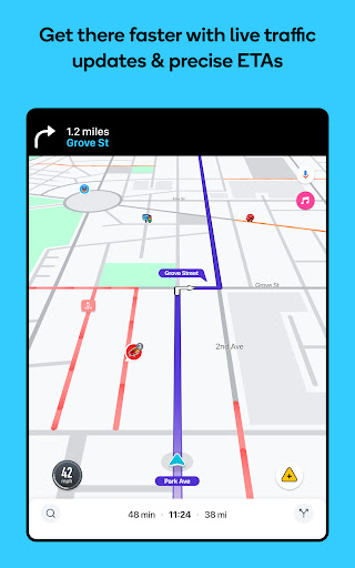


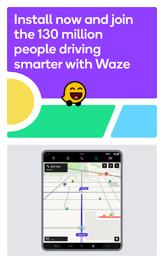
Waze Navigation & Live Traffic is a cutting-edge GPS navigation app that leverages real-time data from millions of drivers worldwide. This innovative mapping solution provides users with live traffic updates, detailed road safety alerts, and accurate estimated time of arrivals (ETAs). The app's comprehensive features include automatic rerouting based on current road conditions, multi-lane guidance, and speed limit notifications.
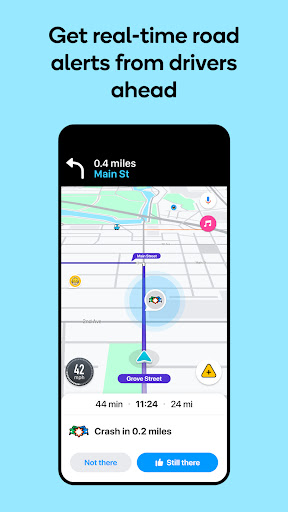
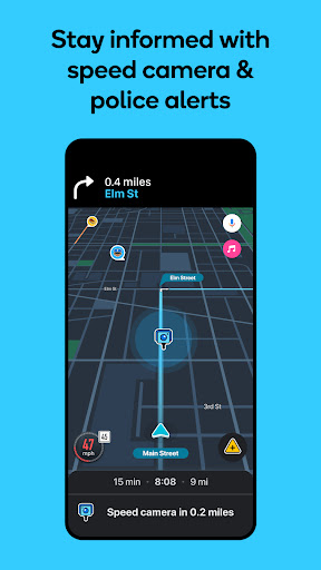
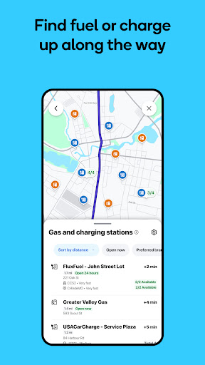
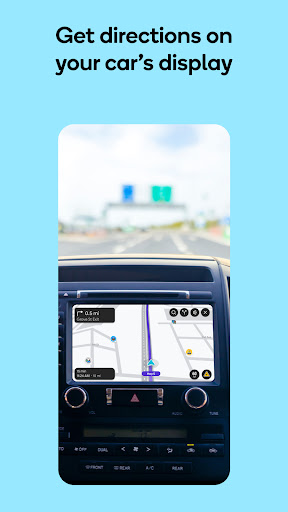
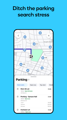
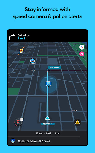
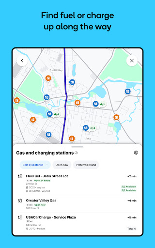
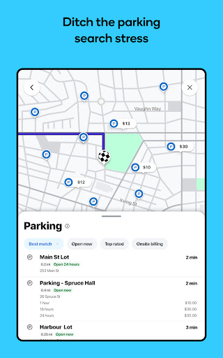
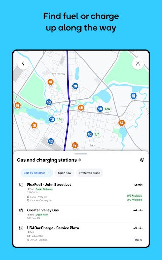
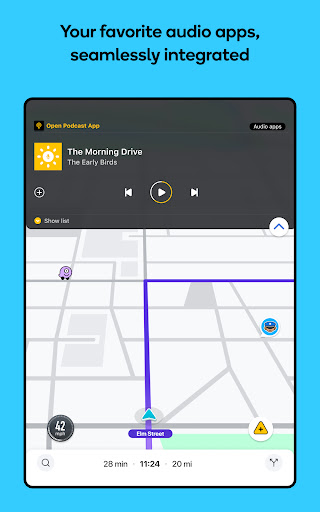
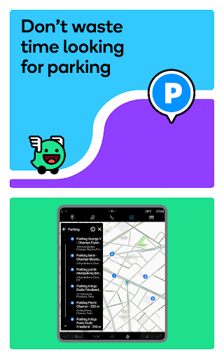
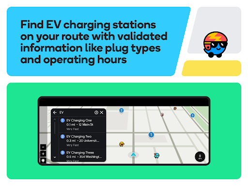
Beyond basic navigation, Waze enhances driving experiences by offering valuable insights such as police locations, red light camera warnings, and real-time incident reporting. Users can also access essential information about petrol stations, EV charging points, and parking facilities along their routes. The app's integration with Android Auto and support for various audio apps make it an indispensable companion for modern drivers seeking safer and more efficient journeys.
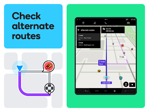
The app's feature set extends far beyond traditional navigation systems. Waze incorporates crowd-sourced traffic data to provide dynamic route adjustments, ensuring drivers always take the fastest available path. Its sophisticated alert system warns users about various road hazards, including accidents, construction zones, and weather-related dangers.
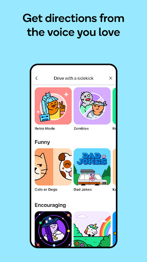
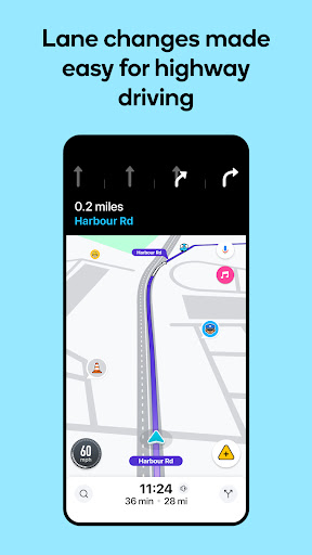
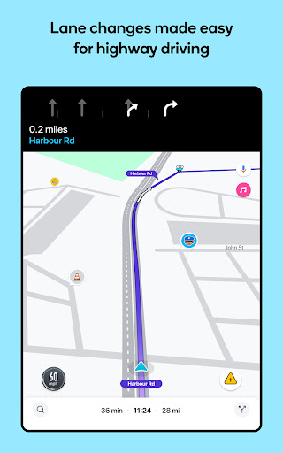
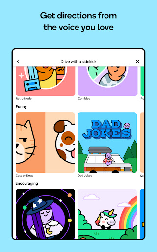
Unique to Waze is its community-driven approach to traffic management. Drivers can actively contribute to the network by reporting incidents, police sightings, and road closures. The app's lane guidance feature helps motorists navigate complex interchanges, while its toll price display and HOV lane support optimize travel costs. Additionally, Waze offers customizable voice guidance in multiple languages and accents, making it suitable for international travelers and diverse user groups.
User-friendly interface
Real-time traffic updates
Comprehensive safety alerts
Community-driven reporting
Voice-guided navigation
Feature limitations in some countries
Not suitable for emergency vehicles
Requires constant internet connection
Occasional inaccurate reports
May drain battery quickly
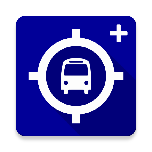
Route schedules, maps, and real-time tracking of MTA buses in New York City.
 4.20
4.20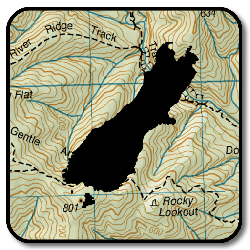
Complete offline 1:50k South Island topo map including DOC Hunting Permit Areas
4.60
Parcel map, property lines, owner, acres, land use, zoning and more from Regrid.
4.60
NJ TRANSIT information and ticketing at your fingertips
3.70
MapQuest is your go-to app for maps, GPS, voice navigation & live traffic.
3.80
Explore offline maps with radar, satellite view, and real-time alerts.
3.60
Route Planner is travel map to get turn by turn navigation & driving directions
3.90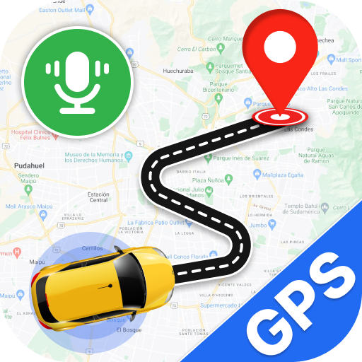
Use GPS Maps and GPS Voice Navigation to find your way and get directions
4.10
Navigate MTA, NJ Transit, MBTA, SEPTA, BART, MARTA, CTA & 900+ cities
4.60
This app is military GPS coordinate systems helper. (MGRS, UTM & DMS Maps)
4.80
Find EV & Tesla charging stations with PlugShare
4.70
Park in Chicago, NYC, Boston, SF, Houston & more!
4.70
GPX Viewer PRO shows tracks, routes and waypoints from gpx and kml files.
4.60
Track friends in real-time and explore worldwide live cameras.
4.60
Use GPS maps or search by property owner, address or parcel to view parcel data
4.30
GPS phone tracker, family locator, secure location sharing app
4.20
Get real-time bus and train schedules for easy, hassle-free city transportation.
3.90
Play in the outdoors with Android as your Handheld GPS and offline topo maps!
3.50
Turn your tablet or Android powered unit into a full blow Android Auto headunit.
2.30


User Reveiws