


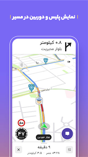


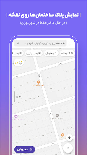


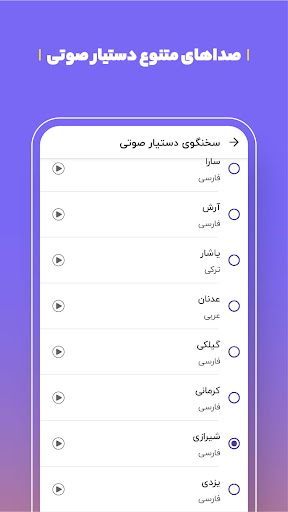

Balad is a comprehensive map and navigation application designed to optimize both inner-city and extra-urban travel. The app provides users with the best routes, while also suggesting ideal locations for leisure, excursions, and services. With real-time alerts on traffic conditions, police presence, accidents, and speed checks, Balad ensures users avoid unnecessary delays and fines. An integrated smart voice assistant enhances safety by audibly guiding users through streets and alleys, reducing the need to look at the phone screen.
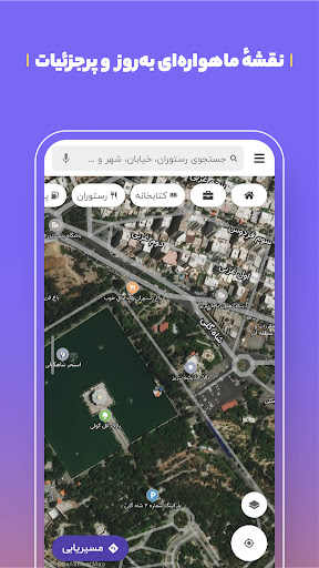
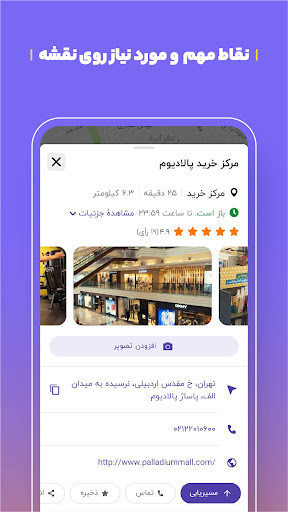
The app features an extensive database of over one million points of interest, complete with up-to-date information such as addresses, phone numbers, and operating hours. Balad stands out with unique functionalities including combined routing options for buses, metros, and taxis, air pollution data layers, and the ability for users to contribute to map improvements. Whether you're a daily commuter or planning a road trip, Balad offers a reliable and intelligent navigation solution.
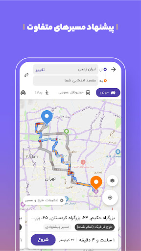
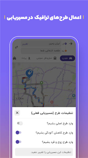
Balad boasts an array of sophisticated features tailored to enhance user experience. Its intelligent routing system considers live traffic updates and environmental factors like air pollution reduction plans. Users benefit from voice search capabilities, removing the need for manual input, and can access detailed metro maps with train timings.
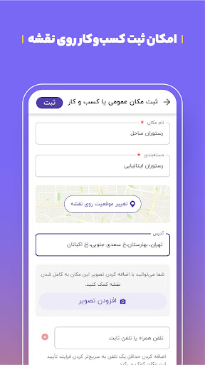
Additional standout features include license plate displays for precise location identification, which is particularly useful for taxi drivers and couriers. The platform supports community engagement by allowing users to participate in updating road conditions and point-of-interest details. This collaborative approach ensures that Balad remains a dynamic and current resource for navigating urban landscapes efficiently and responsibly.
User-friendly interface
Real-time traffic updates
Voice-guided navigation
Comprehensive POI database
Community-driven updates
Occasional GPS inaccuracies
Limited offline functionality
Heavy data usage
Interface clutter
Ad interruptions

GPX Viewer PRO shows tracks, routes and waypoints from gpx and kml files.
 4.60
4.60
OpenCPN is a full featured ChartPlotter and Navigator for Android.
3.60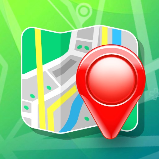
Number locator, real connection map
4.10
Track accurate speed & distance with GPS Speedometer. Check speed limit & time.
4.50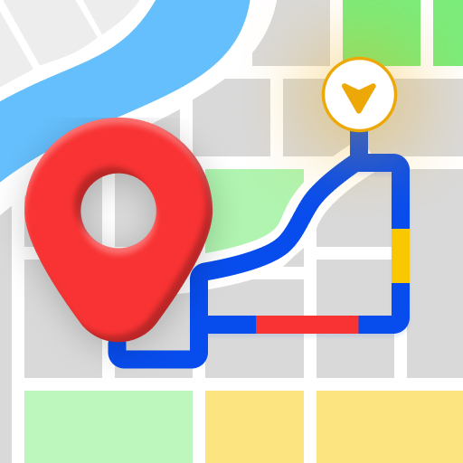
GPS Navigation: Get map directions and find the shortest routes to avoid delays!
4.00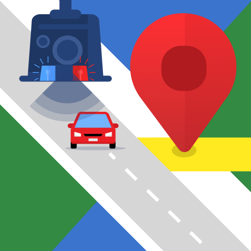
Explore offline maps with radar, satellite view, and real-time alerts.
3.60
Ride or drive at YOUR price
4.70
Neshan: map & navigation app with 20M+ monthly active users
4.50
Get matched with a nearby driver — you’ll be on your way in minutes.
4.30
Offline maps & GPS for hiking, travel, fieldwork & outdoor adventures
4.70
Find EV & Tesla charging stations with PlugShare
4.70
Instant diesel discounts - save big with each fill up!
4.40
Get directions, Maps, GPS navigation & GPS Maps using GPS App
4.10
Discover over 800 points of interest along the canal.
3.70
NJ TRANSIT information and ticketing at your fingertips
3.70
Live Satellite view app for find GPS navigation Direction and live location map
3.70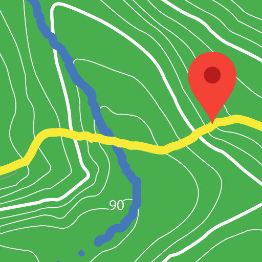
Play in the outdoors with Android as your Handheld GPS and offline topo maps!
3.50
Your real-time window to the world. Explore anywhere, anytime.
3.30
Ride CTA, Metra & Pace: Manage your fares, buy Metra tickets, get arrivals.
3.00

User Reveiws