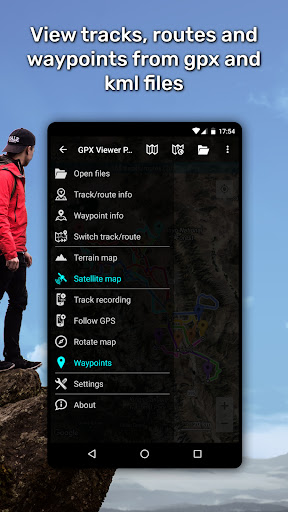
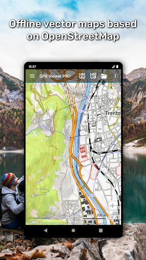
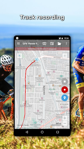


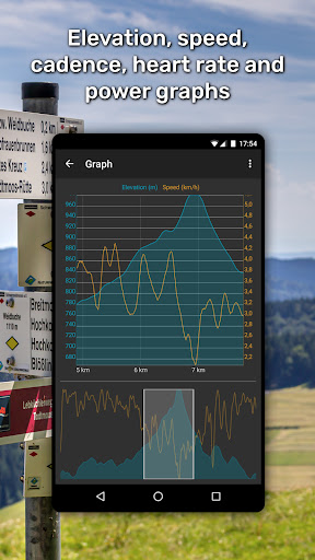


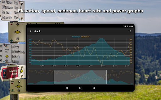
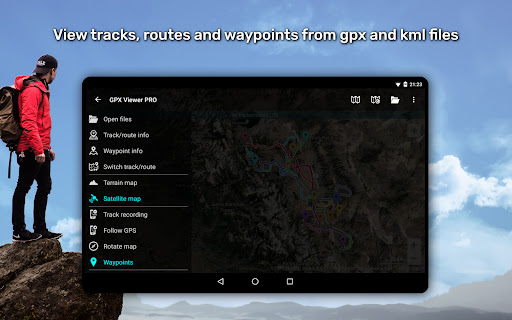
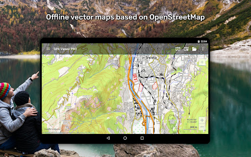


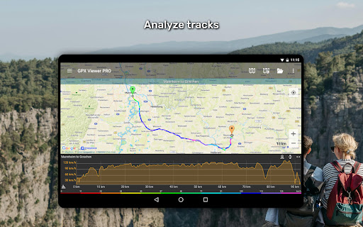

GPX Viewer PRO is a comprehensive GPS and mapping application designed for outdoor enthusiasts and travelers. The app allows users to view GPX, KML, KMZ, and LOC files while offering advanced features such as detailed trip statistics, elevation profiles, and speed graphs. With its offline vector maps functionality, it ensures that users can access maps without an internet connection, making it ideal for remote locations.
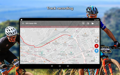
In addition to viewing tracks and routes, the app serves as a simple navigation tool by showing the current GPS position and providing continuous tracking. Users can customize map styles, analyze track data like heart rate and cadence, and even record trips with adjustable profiles. Whether planning a hiking adventure or analyzing past trips, GPX Viewer PRO provides all necessary tools in one place.
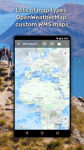
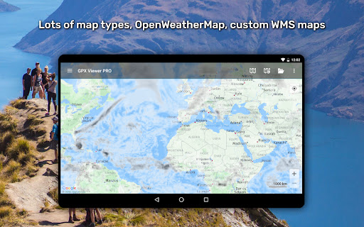
One of the standout features of GPX Viewer PRO is its ability to handle multiple file formats including GPX, KML, and KMZ, allowing users to compress files into GPZ or KMZ archives. The app also offers extensive online map options, integrating services like Google Maps, Mapbox, and OpenStreetMap, along with weather layers from OpenWeatherMap. This makes it versatile for different types of outdoor activities.
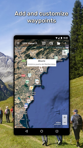
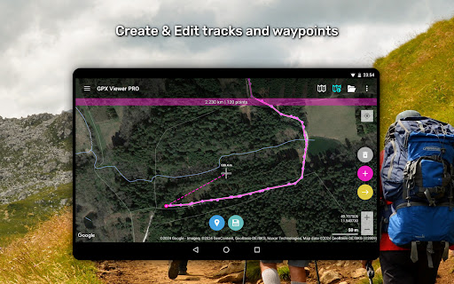
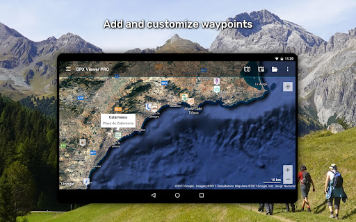
The app includes professional-grade tools such as track recording, editing, and creation capabilities. Users can split or merge tracks, add waypoints, and adjust track colors based on various metrics like elevation or speed. Additionally, the PRO version offers offline maps with monthly updates, ensuring accurate and up-to-date information even without an internet connection.
GPX Viewer PRO also integrates with Trackbook for seamless synchronization of tracks and waypoints. Its highly customizable interface lets users tailor the experience to their specific needs, whether they require detailed analytics, simple navigation, or weather forecasts for upcoming trips.
User-friendly interface
Offline map support
Advanced analytics
Customizable features
Track recording
Paid PRO features
Complex for beginners
Occasional bugs
Limited free maps
High system requirements

Explore a light pollution map to find suitable dark sky locations for observing.
 4.30
4.30
Your guide to the recreational opportunities of the Bureau of Land Management!
3.40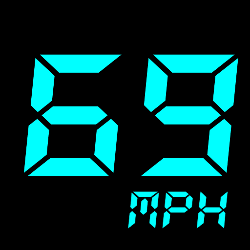
GPS Speedometer & Odometer: Track car, bike, truck speed & distance in real-time
4.70
Find routes fast with GPS Maps, GPS Navigation & driving directions.
4.10
ParkWhiz, an Arrive Mobility brand, part of the Arrive Network
4.30
Gas Station & Fuel Rewards Points
3.70
Live Satellite view app for find GPS navigation Direction and live location map
3.70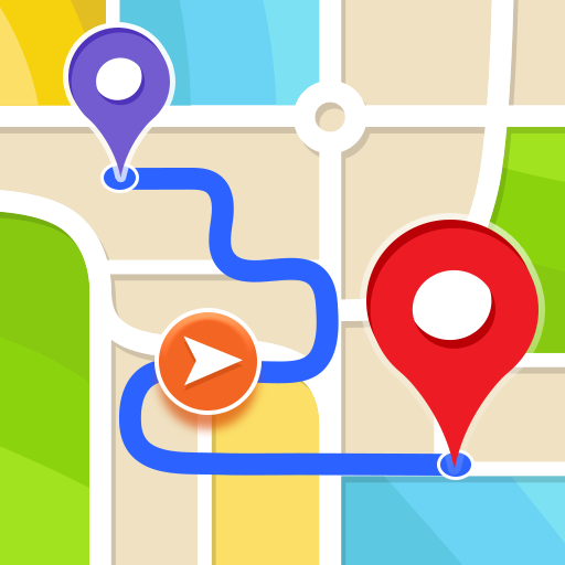
Get route, find shortest path, near by places and weather update
3.90
GPS phone tracker, family locator, secure location sharing app
4.20
Bolt is a ride-hailing app for requesting fast, safe, and affordable transport
4.80
Find trails, organize your locations and navigate with offline maps.
4.60
America’s largest public fast charging network, with over 500 charging stations.
4.50
Route schedules, maps, and real-time tracking of MTA buses in New York City.
4.20
Get route map navigation with 3D satellite view, and live earth camera streaming
3.70
Explore Earth with live GPS, satellite view & street navigation
3.60
Play in the outdoors with Android as your Handheld GPS and offline topo maps!
3.50
Offline maps for phone and smart watch: topographic maps, satellite images...
3.30
Turn your tablet or Android powered unit into a full blow Android Auto headunit.
2.30
Find 93 Octane Gas: Locate Gasoline Stations Selling Premium 93 Octane or Higher
4.1


User Reveiws