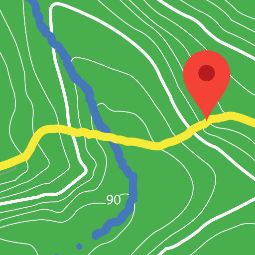
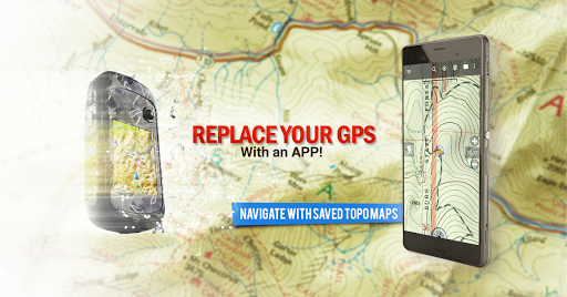


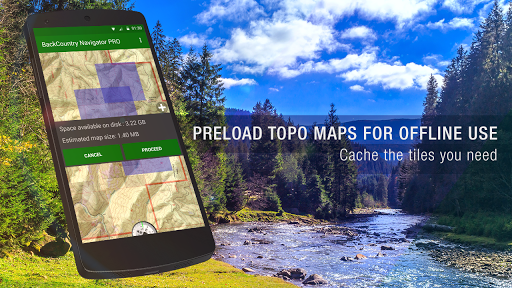


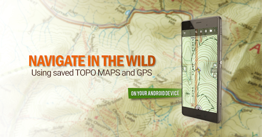


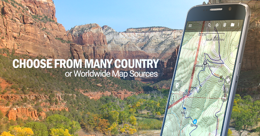

BackCountry Navigator GPS PRO is a premier outdoor navigation app that transforms your Android device into an advanced offline GPS system. Designed for adventurers, this app allows you to download topographic maps for offline use, making it perfect for hiking, hunting, and other outdoor activities beyond cell coverage areas.
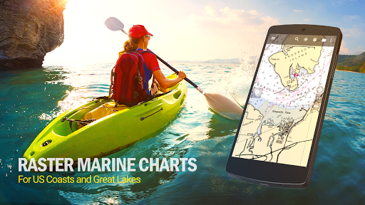
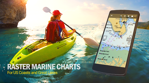
The application supports various map formats including topo maps for the US and many other countries, marine maps, and aerial photography. With its ability to integrate GPS waypoints from GPX or KML files, users can navigate with precision using coordinates in multiple formats. Whether you're exploring trails or planning a hunt, BackCountry Navigator provides detailed mapping options and reliable navigation tools.
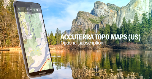
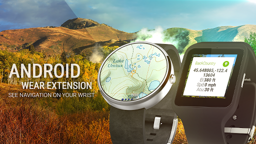
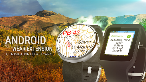
This versatile app also features Android Wear support, enabling glanceable navigation on your wrist. It offers both free and premium map sources, enhancing your outdoor experience with additional paid content like Accuterra Topo and Thunderforest Maps. BackCountry Navigator GPS PRO is an essential tool for anyone seeking safe and enjoyable adventures in the wilderness.
BackCountry Navigator GPS PRO stands out with its comprehensive feature set tailored for outdoor enthusiasts. The app's core functionality lies in its robust offline capabilities, allowing users to download and store detailed topo maps directly on their devices. This ensures uninterrupted navigation even in areas without cellular service, which is crucial for backcountry exploration.
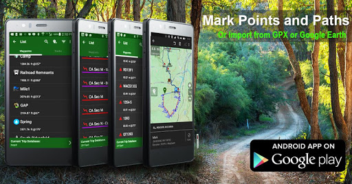
Beyond basic mapping, the app supports advanced GPS functionalities such as waypoint management through various file formats (GPX, KML) and manual coordinate entry in different systems (longitude/latitude, UTM, MGRS). Users can overlay valuable information like Bureau of Land Management boundaries and lake contours, making it particularly useful for hunters and anglers. The inclusion of worldwide map sources and specialized trail maps adds another layer of versatility.
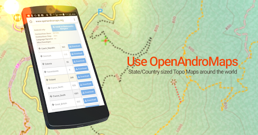
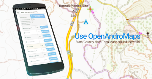
What truly sets this app apart is its flexibility in map sourcing and customization. From built-in sources like OpenStreetMaps and USGS maps to custom tile server integration, users have unprecedented control over their mapping experience. The optional premium content and Android Wear support further enhance its value proposition, making BackCountry Navigator GPS PRO a complete solution for serious outdoor adventurers.
Comprehensive offline mapping
Multiple coordinate systems
Wide range of map sources
Android Wear integration
Advanced waypoint management
Premium content costs extra
Steep learning curve
Large storage requirements
Limited free map updates
Complex setup process

This app is military GPS coordinate systems helper. (MGRS, UTM & DMS Maps)
 4.80
4.80
Fully offline 1:50k New Zealand topographical map North Island
4.0
All of NHSA's trail information at your fingertips for the 2025-2026 season
4.1
Airport parking, with airport shuttle (TPS shuttle), reservations, and Spot Club
4.80
Get directions, Maps, GPS navigation & GPS Maps using GPS App
4.10
Navigate via GPS Maps of GPS Voice Navigation, driving directions to find routes
3.60
Explore offline maps with radar, satellite view, and real-time alerts.
3.60
Park in Chicago, NYC, Boston, SF, Houston & more!
4.70
Get real-time bus and train schedules for easy, hassle-free city transportation.
3.90
Truck Safe GPS Navigation & Maps: Parking, Fuel, Diesel, Weight Station
4.80
Bolt is a ride-hailing app for requesting fast, safe, and affordable transport
4.80
Voice GPS with driving directions, offline maps navigation GPS for safe travel
4.50
Plan routes, share locations, and set custom alert zones
4.40
Explore a light pollution map to find suitable dark sky locations for observing.
4.30
Route schedules, maps, and real-time tracking of MTA buses in New York City.
4.20
Simple & easy to use a compass app. Get accurate directions.
4.20
Find routes fast with GPS Maps, GPS Navigation & driving directions.
4.10
Route Planner is travel map to get turn by turn navigation & driving directions
3.90
Gas Station & Fuel Rewards Points
3.70

User Reveiws