


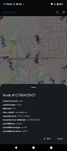


DeFlock.me is a privacy-focused mapping and navigation application designed to help users identify AI-powered surveillance devices in their vicinity. The app provides an essential tool for individuals concerned about privacy, allowing them to discover the locations of surveillance cameras, automatic license plate readers (ALPRs), and other monitoring infrastructure.
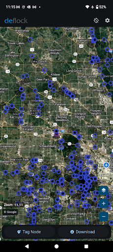
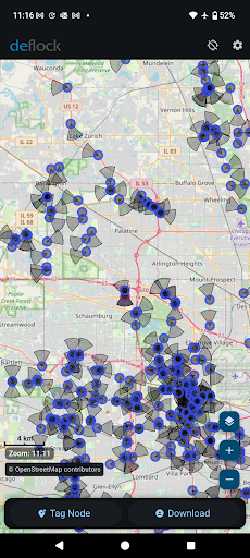
The platform leverages community-driven data through OpenStreetMap, ensuring that no personal information is collected or tracked. With its open-source nature, DeFlock.me empowers users to take control of their privacy by mapping out areas with surveillance equipment, thus enabling informed decisions when navigating through neighborhoods.
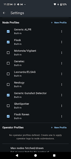
DeFlock.me offers a comprehensive set of features tailored for privacy-conscious individuals. Users can easily report newly discovered surveillance devices, contributing to a growing database powered by community input. The app's interface allows for intuitive exploration of mapped areas, highlighting potential surveillance threats.
One of the standout features is its commitment to user privacy. Unlike many other mapping applications, DeFlock.me operates on a strict no-data collection policy. This ensures that users can explore and report without worrying about their activities being tracked or monetized, making it a reliable choice for those prioritizing digital privacy.
User-friendly interface
Community-driven data
Privacy-first approach
No ads or tracking
Open-source platform
Limited device compatibility
Dependent on user reports
Occasional data delays
Basic UI design
Requires manual updates
Easy, Moderate and difficult offroad adventures.
 4.00
4.00
Play in the outdoors with Android as your Handheld GPS and offline topo maps!
3.50
All of NHSA's trail information at your fingertips for the 2025-2026 season
4.1
Order a cab online. An affordable taxi ride and driver in no time. What a bolt!
4.80
Affordable rides and food delivery with incredible discounts in just one app.
4.50
Explore with GPS Navigation with GPS offline, voice GPS, speed camera radar
4.60
Live Satellite view app for find GPS navigation Direction and live location map
3.70
Get route, find shortest path, near by places and weather update
3.90
Navigate MTA, NJ Transit, MBTA, SEPTA, BART, MARTA, CTA & 900+ cities
4.60
This app is military GPS coordinate systems helper. (MGRS, UTM & DMS Maps)
4.80
Find shortest way and save energy . Distance and area calculator.
4.70
Find EV & Tesla charging stations with PlugShare
4.70
Park in Chicago, NYC, Boston, SF, Houston & more!
4.70
Find trails, organize your locations and navigate with offline maps.
4.60
CamSam PLUS - The speed and red light camera warning system!
4.40
ParkWhiz, an Arrive Mobility brand, part of the Arrive Network
4.30
GPS phone tracker, family locator, secure location sharing app
4.20
NJ TRANSIT information and ticketing at your fingertips
3.70
Find 93 Octane Gas: Locate Gasoline Stations Selling Premium 93 Octane or Higher
4.5


User Reveiws