


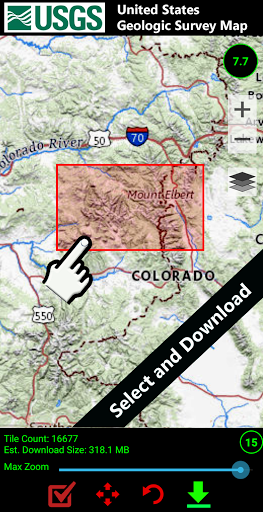


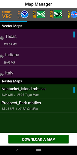
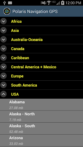


GPS Waypoints Navigator is a comprehensive navigation app that transforms your phone into a powerful GPS tool, ideal for outdoor enthusiasts and professionals alike. The app provides extensive offline map support, making it reliable even without network coverage. With over 400 maps in its library, users can download and store maps on their SD card to save internal memory.
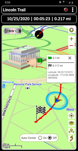
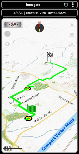
The app's core functionality revolves around waypoint management, trail recording, and location sharing. It offers advanced features like coordinate-tagged photos, multiple map sources including Topo and Satellite maps, and compatibility with KML, GPX, and KMZ files. Whether you're hiking, boating, or exploring urban areas, this app ensures accurate navigation and data organization.
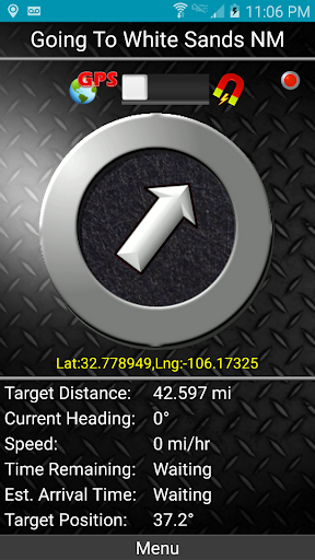
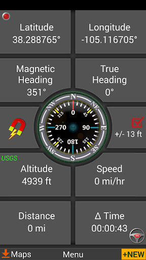
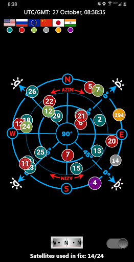
Designed for various activities such as trail hiking, maritime navigation, and geocaching, GPS Waypoints Navigator stands out with specialized tools like military coordinate finders, navigational compasses, and altitude profiles. Its versatility makes it suitable for both recreational use and professional applications like surveying and hunting.
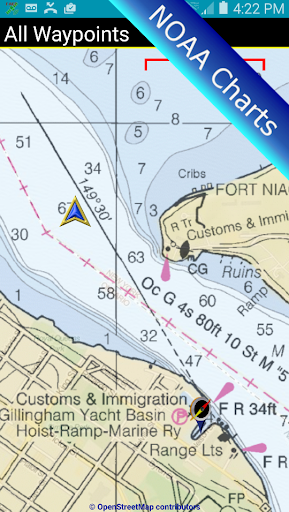
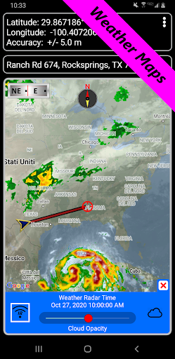
One of the standout features of GPS Waypoints Navigator is its extensive map options. Users can choose from multiple map sources including Google Maps, OpenStreetMaps, and NOAA Nautical Charts. The inclusion of offline maps ensures uninterrupted navigation regardless of cellular coverage, while the ability to transfer maps to an SD card helps manage device storage efficiently.
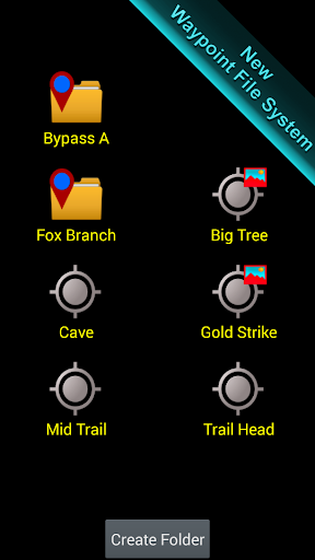
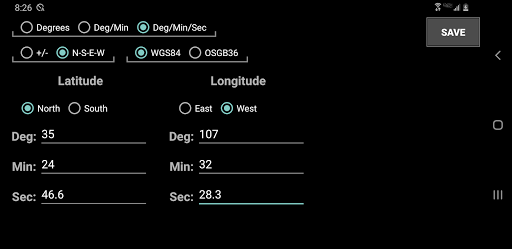
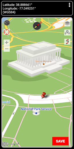
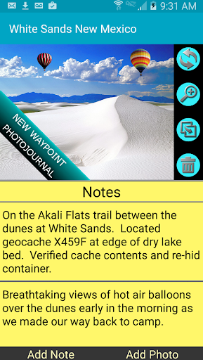
The app excels in waypoint and trail management. It offers unique systems for organizing waypoints and trails, including a distinctive filing system and photojournal capabilities. Users can create waypoints through various methods such as entering coordinates, dropping pins, or saving current positions. The app also supports different coordinate formats including UTM and MGRS, catering to diverse user needs.
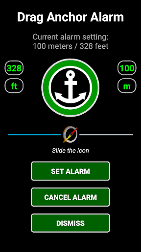
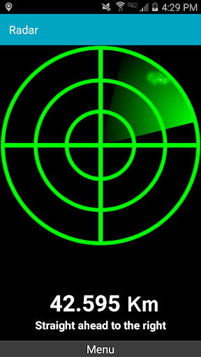
Additional features enhance the overall navigation experience. The dynamic waypoint compass and GPS Reflected Pseudo-Radar provide precise guidance, while proximity alerts and drag anchor notifications add extra safety measures. Integration with Google Earth and support for GPX file imports/exports make this app a versatile tool for both casual explorers and serious adventurers.
User-friendly interface
Extensive offline map support
Versatile waypoint creation tools
Comprehensive file format compatibility
Dedicated customer service
Steep learning curve for beginners
Occasional GPS signal issues
Limited advanced features in free version
Large app size
Some features region-restricted

This app is military GPS coordinate systems helper. (MGRS, UTM & DMS Maps)
 4.80
4.80
Play in the outdoors with Android as your Handheld GPS and offline topo maps!
3.50
Voice GPS with driving directions, offline maps navigation GPS for safe travel
4.50
Use GPS maps or search by property owner, address or parcel to view parcel data
4.30
Your real-time window to the world. Explore anywhere, anytime.
3.30
Affordable rides and food delivery with incredible discounts in just one app.
4.50
ParkWhiz, an Arrive Mobility brand, part of the Arrive Network
4.30
Park in Chicago, NYC, Boston, SF, Houston & more!
4.70
Neshan: map & navigation app with 20M+ monthly active users
4.50
Airport parking, with airport shuttle (TPS shuttle), reservations, and Spot Club
4.80
Bolt is a ride-hailing app for requesting fast, safe, and affordable transport
4.80
Truck Safe GPS Navigation & Maps: Parking, Fuel, Diesel, Weight Station
4.80
Navigate confidently with our precise Digital Compass app & Direction Compass!
4.70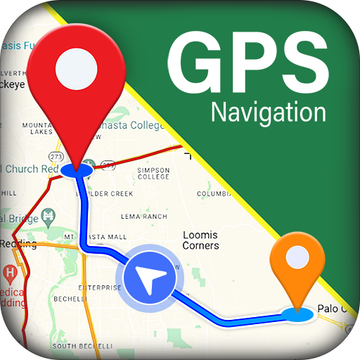
GPS navigation offers route finder, compass, translator, currency converter, etc
4.30
Navigate seamlessly with Real-Time Traffic, Offline Maps, and Voice Navigation.
4.10
Use GPS Maps and GPS Voice Navigation to find your way and get directions
4.10
Gas Station & Fuel Rewards Points
3.70
OpenCPN is a full featured ChartPlotter and Navigator for Android.
3.60
Explore Earth with live GPS, satellite view & street navigation
3.60

User Reveiws