
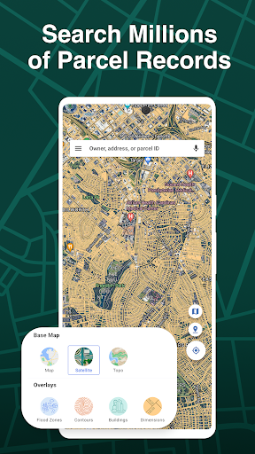
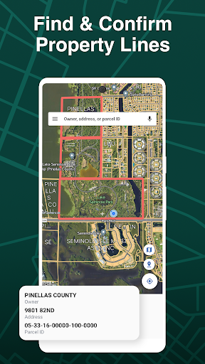


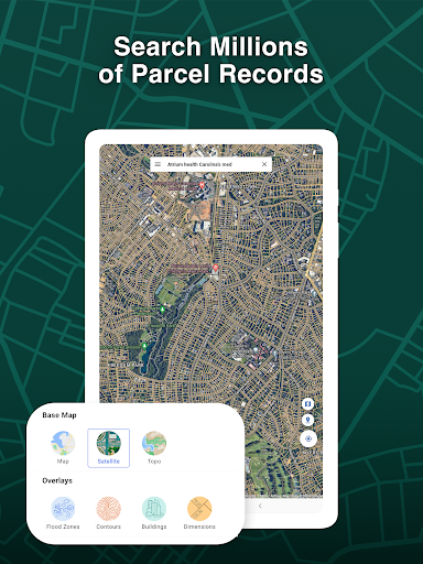
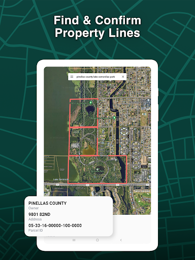


LandGlide is a premier property data app designed for real estate professionals, surveyors, and land researchers. It provides advanced parcel data including property lines, ownership history, and detailed building information. With access to 160 million parcel records across the U.S., it covers over 99% of the population, making property search seamless.
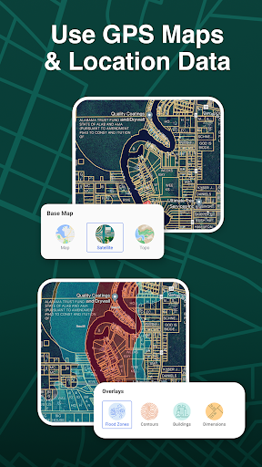
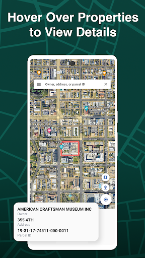
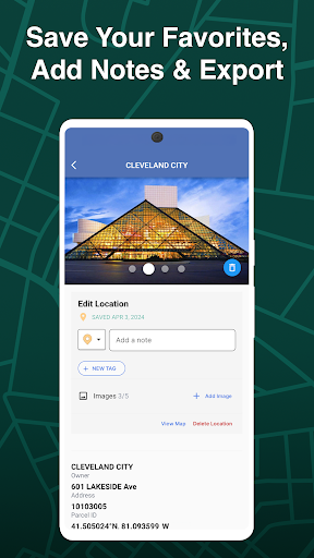
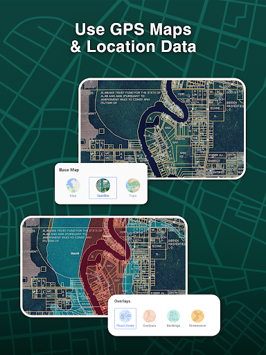
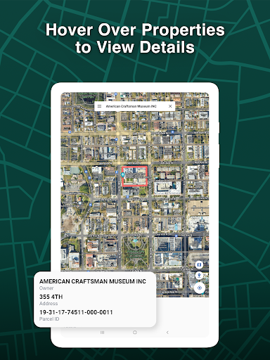
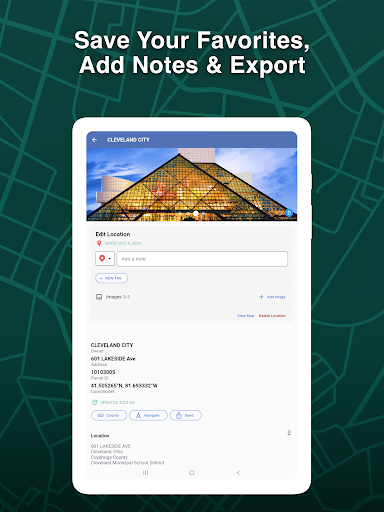
The app features GPS functionality to pinpoint locations and identify property boundaries anywhere. Users can search properties by owner, address, or parcel number, instantly viewing details like land use, sale price, and tax information. LandGlide also supports saving favorite locations, adding notes, and exporting data, ensuring maximum utility for fieldwork and office tasks.
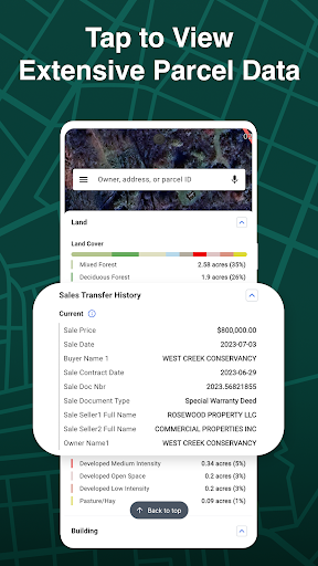
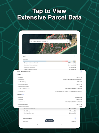
LandGlide stands out with its comprehensive property insights, offering up to 100+ parcel attributes such as sales transfer history, land use, and building specifics. Its offline and online access ensures reliable data availability regardless of location. The app's GPS integration allows users to locate themselves on parcel maps, while hover functionality provides instant property details.
Additional features include the ability to save favorite properties, add custom notes, and upload photos. Designed for both mobile and desktop use, LandGlide streamlines workflows for real estate professionals. Subscription plans start with a free trial, followed by flexible monthly or annual pricing, ensuring accessibility for all types of users.
Comprehensive parcel data
Offline and online access
GPS-enabled property mapping
Instant property detail views
User-friendly interface
Paid subscription required
Limited international coverage
Advanced features may overwhelm beginners
Occasional data sync delays
Higher cost for yearly plan

Fully offline 1:50k New Zealand topographical map North Island
 4.0
4.0
Turn your tablet or Android powered unit into a full blow Android Auto headunit.
2.30
Number locator, real connection map
4.10
Order a cab online. An affordable taxi ride and driver in no time. What a bolt!
4.80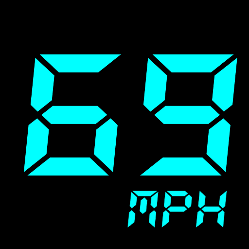
GPS Speedometer & Odometer: Track car, bike, truck speed & distance in real-time
4.70
Live Satellite view app for find GPS navigation Direction and live location map
3.70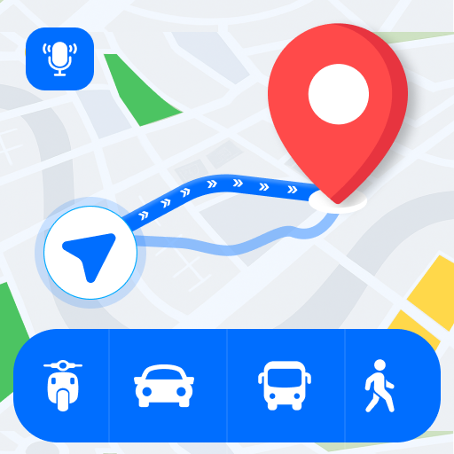
Route Planner is travel map to get turn by turn navigation & driving directions
3.90
Off-Roading Navigation App With Trails, Public Lands, & Private Property Info
3.30
Track friends in real-time and explore worldwide live cameras.
4.60
Offline maps & GPS for hiking, travel, fieldwork & outdoor adventures
4.70
Navigate with your watch and keep the phone in your pocket!
4.60
Parcel map, property lines, owner, acres, land use, zoning and more from Regrid.
4.60
Explore with GPS Navigation with GPS offline, voice GPS, speed camera radar
4.60
Track accurate speed & distance with GPS Speedometer. Check speed limit & time.
4.50
Lets explore the world's famous places by using Live Cams, GPS & Satellite View.
4.20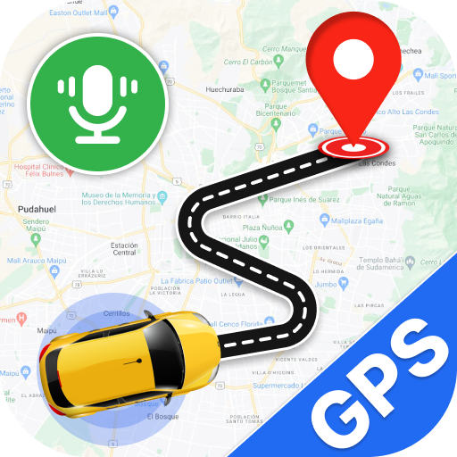
Use GPS Maps and GPS Voice Navigation to find your way and get directions
4.10
Start your next adventure confidently using our Accurate Compass App
3.70
OpenCPN is a full featured ChartPlotter and Navigator for Android.
3.60
All of NHSA's trail information at your fingertips for the 2025-2026 season
4.1


User Reveiws