


Tactical NAV is a specialized navigation application designed for military use, particularly developed to enhance soldier safety and mission success. Created during a combat deployment in Afghanistan, this app serves as a tribute to fallen soldiers and focuses on providing accurate navigation through MGRS coordinates.
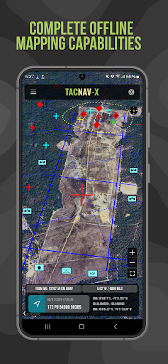
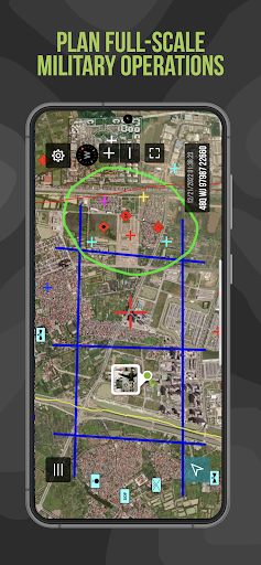
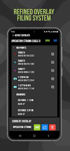
The app offers advanced features such as offline mapping capabilities, tactical drawing mode, and precise waypoint plotting. These tools are essential for mission planning and execution in austere environments. Tactical NAV's accuracy rivals official DoD-issued systems, making it an invaluable asset for military personnel both in training and real-world scenarios.
Tactical NAV stands out with its military-grade precision targeting platform and purpose-built design for individual soldiers. The app supports WGS-84 standards including MGRS, UTM, BNG, and USNG coordinates, ensuring compatibility with global military operations.
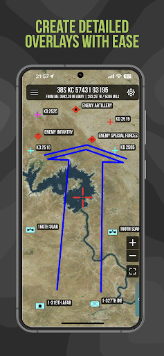
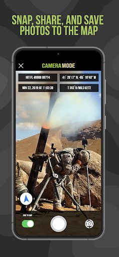
Key functionalities include the 'Compass FastLock' for capturing quick azimuths, tactical drawing mode for mission planning, and waypoint plotting with military graphics. Users can also snap and share photos directly onto maps, increasing situational awareness. These comprehensive features make Tactical NAV suitable for both strategic planning and field operations.
Highly accurate navigation
Offline mapping capabilities
Military-grade features
Essential for mission planning
Supports multiple coordinate systems
No DoD endorsement
Not for life-threatening situations
In-app purchases required
Limited to military use
Subscription model for some features

All of NHSA's trail information at your fingertips for the 2025-2026 season
 4.5
4.5
Airport parking, with airport shuttle (TPS shuttle), reservations, and Spot Club
4.80
Use GPS maps or search by property owner, address or parcel to view parcel data
4.30
Navigate confidently with our precise Digital Compass app & Direction Compass!
4.70
Live Satellite view app for find GPS navigation Direction and live location map
3.70
Get route, find shortest path, near by places and weather update
3.90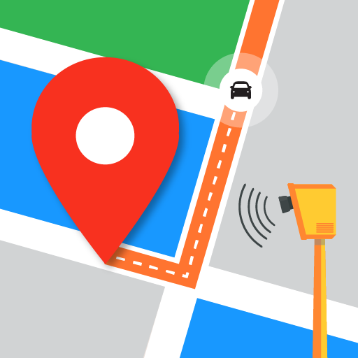
Find radar, speed camera, flight tracker. Use hud, location tracker, speedometer
4.20
Neshan: map & navigation app with 20M+ monthly active users
4.50
Avoid delays. Get real-time GPS navigation, safety alerts and live traffic.
4.10
Bolt is a ride-hailing app for requesting fast, safe, and affordable transport
4.80
Find EV & Tesla charging stations with PlugShare
4.70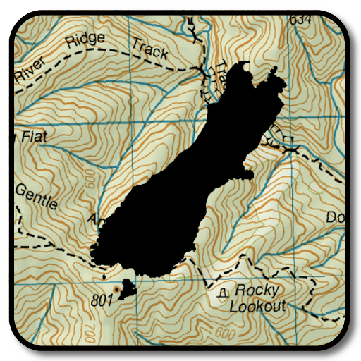
Complete offline 1:50k South Island topo map including DOC Hunting Permit Areas
4.60
America’s largest public fast charging network, with over 500 charging stations.
4.50
Rideshare, taxi cabs, and more for your airport travels and everyday trips.
4.50
"Balad" is a map and navigator with a Persian voice assistant and a complete city guide
4.40
Find radar maps, GPS coordinates, altitude, offline maps, location, travel route
4.40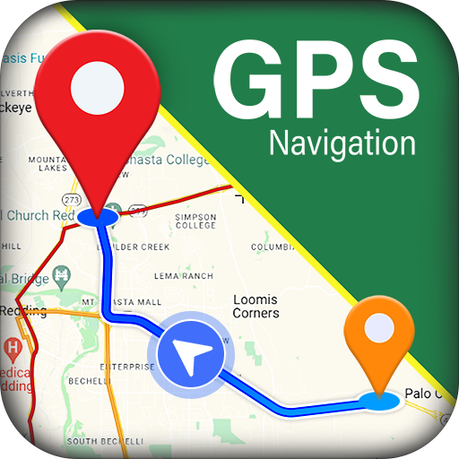
GPS navigation offers route finder, compass, translator, currency converter, etc
4.30
Explore Live Earth Map with 3D World Map & locate cites, mountains real time.
3.80
Fully offline 1:50k New Zealand topographical map North Island
4.5

User Reveiws